2011 Fieldwork Overview
This summer, as far as excavation was concerned, we concentrated our attention on Dampney Barrow. At the same time, further geophysics – mainly gradiometer survey – was undertaken in some areas left unfinished from 2010.
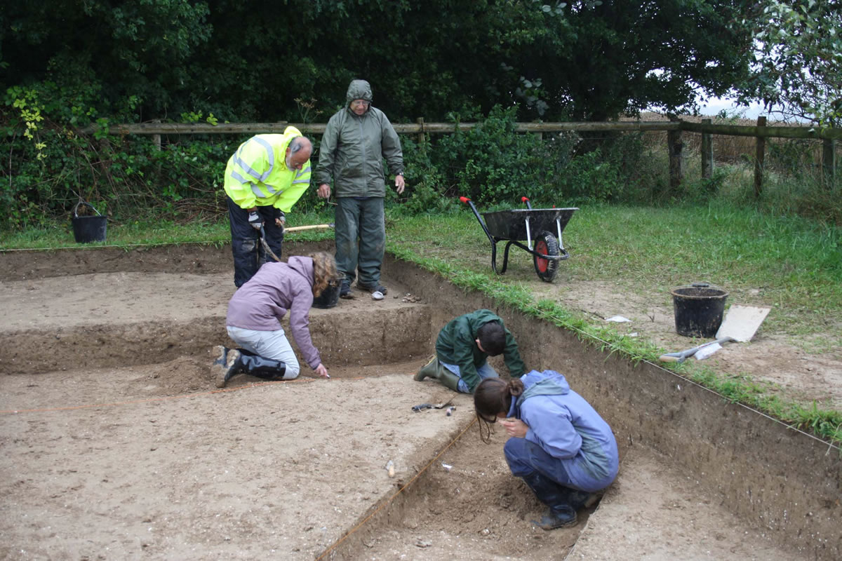
Excavations well underway over the terminal of Dampney Barrow’s ditch.
We chose to examine Dampney Barrow in two places. Aerial photographs had clearly shown the mound and its flanking ditches both as cropmarks and soilmarks within arable. However, the 2009 resistivity survey in the adjacent paddock, located directly in front of the mound’s larger, eastern end, showed that the southern ditch continued beyond the fence boundary and into this grassed area. Accordingly, a trench was opened over it. The aim was to expose as much of the ditch terminal as possible – it was not possible to uncover its full width, as the southern edge of the ditch lay beyond another fence, within a wooded area adjacent to the mound.

With the crop off, a determined attempt to investigate the mound of Dampney Barrow.
Auguring of the ditch on the northern side suggests a maximum depth of at least 2.2 metres – perhaps considerably more. Both ditches are approximately 7 metres wide for much of their length, but the geophysics showed that where we were excavating, the ditch widened appreciably. The presence of the fenced woodland meant that we could not get an exact measurement, but clearly where we were excavating we were looking at something comfortably more than 7 metres wide – perhaps 9 or 10 in total. A very substantial feature in other words, and one which we could presume to have a very complicated process of infilling for us to investigate. In the time available, a complex sequence of fills were examined, most –judging by the finds – belonging to the Iron Age and Roman (as well as more recent) periods, although by the end of our time on site, Neolithic material was beginning to turn up. The excavated areas were carefully covered before the trench was backfilled, so that we can pick up where we left off next year.
The other trench was out in the arable field. Unfortunately, the harvest was late so we had far less time than we had hoped, but again we can continue next year. We were interested in the anomaly in the northern side of the mound, which we had previously suggested might represent traces of an early excavation. This seemed an obvious place to open a trench, as it would allow us to have a look at the condition and structure of the mound with only the minimum of disturbance to the mound itself. This would help considerably with planning for more extensive excavation in future years. At the same time, we were also interested in the anomaly itself. Was it really an early excavation trench? If so, could we find out roughly when it happened? What methods were used?
We wanted to set the trench along the edge of this old cut, so that interface between the mound and the digging would run down the centre of our trench. We located where we wanted to dig the trench from the Project GIS, overlying the aerial survey plot and the geophysics results onto a 3D model of the mound created from topographic survey

A sterling effort by all concerned on a small trench in front of the barrow mound. Sadly, it proved to be featureless.
The results were certainly intriguing. In the time available, we felt we couldn’t justify cutting in to the mound itself. Investigation of the earlier cut meanwhile brings into question the idea that it might represent an early archaeological excavation. It may instead be the result of chalk extraction, perhaps as early as the Medieval period, by someone who had no idea that it was an artificial mound.
Whoever dug ot doesn’t appear to have backfilled it either. Instead, it was left open, and has been filled over time through a combination of natural and agricultural processes. Initially, chalk and soil eroded in from the sides, but the bulk of the fill was more recent, and included quantities of chalk from the mound brought in by the plough. Evidence for a substantial episode of burning was found just above the natural chalk, near the bottom of our trench, although this may have occurred a little while after it was dug. Hopefully when we return next year, as well as investigating the Neolithic mound, we may also find out more about the date and purpose of this more recent activity.